Learning Lessons from the Majene Earthquake with ITS Researcher

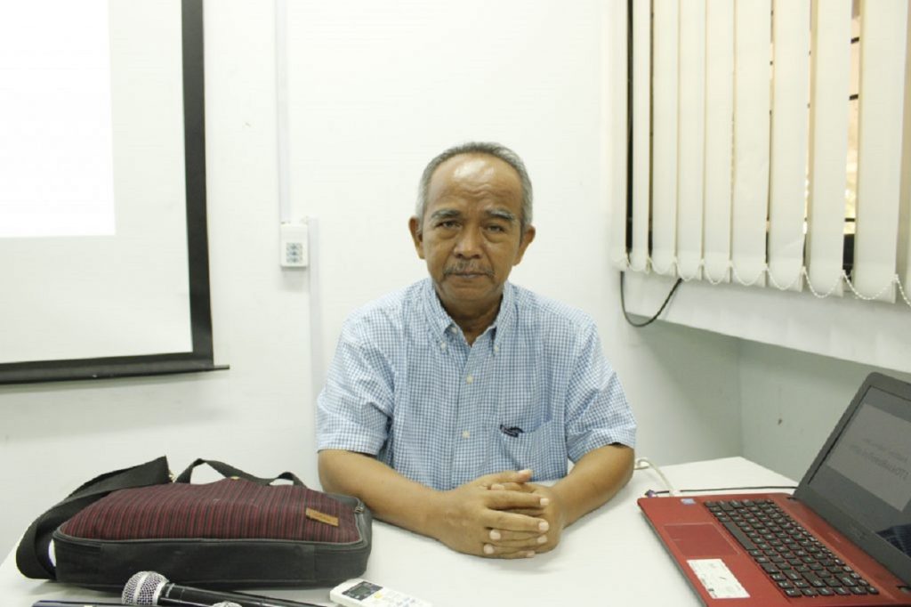
Senior Researcher from ITS Research Center for Mitigation, Disaster and Climate Change (MKPI), Dr. Ir Amien Widodo MSi
ITS Campus, ITS News – Not yet overcoming the Covid-19 pandemic, earlier this year Indonesia was shocked by a variety of natural disasters that occurred in succession. This has become commonplace because Indonesia’s unique geographic location makes this country not only has the potential for natural wealth, but also the potential for natural disasters. One of them is the earthquake in Majene, West Sulawesi, which was broadcast in succession, causing many casualties.
Met at the Research Center for Disaster Mitigation and Climate Change (Puslit MKPI) Sepuluh Nopember Institute of Technology (ITS), Dr. Amien Widodo revealed that the location of Majene Regency is in a fault zone, where there is tension in the bowels of the earth that can cause shifts or faults. Historically, on February 23, 1969, there was a large earthquake measuring 6.9 on the Richter Scale (SR) at a depth of 13 kilometers there.
This senior researcher from the ITS MKPI Research Center then explained that the fault in Majene was a fault that was still very active. This is shown by the frequent shifts and earthquakes that follow these shifts. “The active fault in Majene is an upward fault that often causes shallow earthquakes there, as recently (happened),” he said.

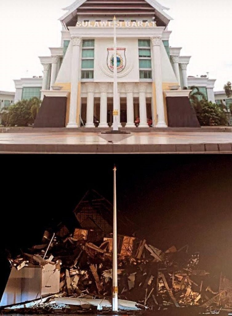
Portrait of the West Sulawesi Governor’s Office before and after the earthquake in Majene
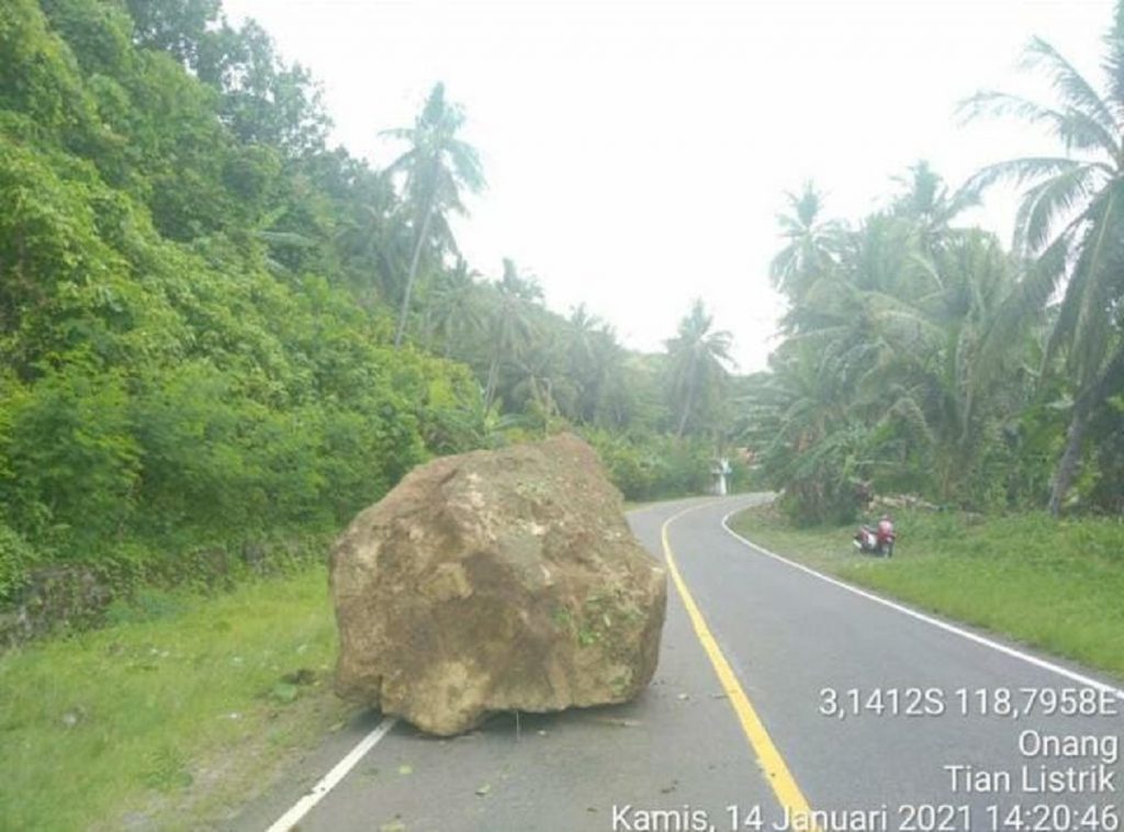
The opening earthquake recorded by the Meteorology, Climatology and Geophysics Agency (BMKG) occurred at 13.35 WIB at a depth of 10 kilometers with a magnitude of 5.9 SR. This scale is estimated to have the potential to cause damage. “Sure enough, the earthquake triggered a rockfall (rock debris) in the hills which then damaged people’s homes there,” said Amien.
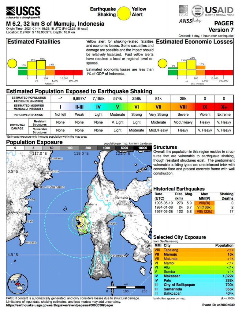
The earthquake event is referred to as an opening earthquake ( foreshock ). Because after the next day, Friday (15/1), 28 aftershocks were recorded in Majene with varying magnitudes. “For example, the second earthquake with a magnitude of 6.2 on the Richter scale was felt not only in Majene but also in Mamuju and Palu,” he said.
The earthquake that shook Majene and Mamuju had an intensity scale of V-VI Modified Mercalli Intensity (MMI). At this level, an earthquake has the potential to cause damage. Meanwhile, in Mamuju Tengah, Palu, Mamuju Utara, and Mamasa, objects were knocked over by the earthquake with an intensity scale of III-IV MMI.

Mamuju-Majene earthquake occurrence-map illustration combined with population density for a rapid assessment published by the USGS one day after the earthquake
“Seeing the impact and the magnitude of its greater strength than before, while the incident which occurred on Friday (15/1) in the early hours of the morning was designated as the main earthquake ( mainshock ),” he said, quoting a BMKG statement.
Amien continued, everyone hopes that this decision will not change and instead weaken. Thus, there is no greater earthquakes and aftershocks left ( aftershock ) whose strength is getting smaller until the situation stabilizes. “However, we must remember very well the history of the Majene coast which was hit by the tsunami in 1969 due to the fold-thrust belt (the type of deformation belt fold area, red) of the Majene fault which is located offshore,” appealed the lecturer of the ITS Geophysical Engineering Department.
The report from the Operational Control Center for Badan Nasional Penanggulangan Bencana (BNPB) as of January 17, 2021, states that the number of victims who died as a result of the 6.2 magnitude earthquake on 15 January 2021 then increased to 70 people from Mamuju and 11 people from Majene. A total of 189 people were seriously injured and had to receive treatment in Mamuju and around 637 people who were injured in Majene received outpatient treatment. “The rest, about 15,000 residents spread across ten refugee points,” he said concerned.
Meanwhile, the Majene-Mamuju road section was cut off due to a landslide. About 1,150 housing units in Majene were recorded as having suffered damage and 15 schools were also affected. Meanwhile, in Mamuju, heavy damage was also recorded in the office of the Governor of West Sulawesi and the Mamuju Regional General Hospital (RSUD).

Rocks and landslides that hit the Majene-Mamuju road after the earthquake occurred
Recommendations and Lessons from the Active Majene Earthquake Fault for the Surabaya Community
In the 2017 National Earthquake Center report, it was stated that many cities in Indonesia were passed by active faults that could potentially lead to earthquakes. The report, which is presented in the form of an earthquake hazard map, shows the potential for earthquakes due to active faults as well as its presence in East Java Province. Among them are the Wonorejo fault in Banyuwangi Regency, the Probolinggo fault in Probolinggo Regency, and the Pasuruan fault in Pasuruan Regency.
“The city of Surabaya is even passed by two different faults, which are the Surabaya fault and the Waru fault,” he explained regarding the distribution of faults in Surabaya. The Waru fault extends from Gresik, through Mojokerto, Jombang, Nganjuk, to Saradan. These faults are still active and experience an annual average of 0.05 millimeters. So it is appropriate, said Amien, to be aware of earthquakes and minimize losses that may occur.
Before it got out of control, he continued, the East Java Provincial Government (Pemprov Jatim) and especially the Surabaya City Government (Pemkot) should have prepared anticipatory steps. Amien advised the government to conduct an earthquake threat assessment, assess the vulnerability of buildings and soil vulnerabilities, and assess the capacity of the community.
“If the area has poor soil conditions and less solid buildings, then it can be categorized as high-risk areas,” he said. On the other hand, if the soil layer condition is strong and the building is strong, then the area can be included in the classification of low-risk areas.
Based on the zoning map of areas with low to high-risk levels, it can be made and used as a mitigation mold. Each region will most likely have different mitigation directions, according to that leveling. Both structural mitigation instructions, as well as non-structural mitigation instructions, are both equally important and necessary to be communicated to the public.
Natural disasters will not cause casualties if they occur in uninhabited areas. However, it is not impossible to avoid huge losses in densely populated areas. “So, let’s identify disaster. We are familiar with disasters, we are saved, “he concluded.(qaf/nadh/ITS Public Relations)
Related News
-
ITS Collaboration with BPBD East Java, Launching VR Disaster Simulation
ITS Campus, ITS News — Supporting anticipation of disasters and continuing to educate the public, Institut Teknologi Sepuluh Nopember
January 16, 2021 17:01 -
Supporting the Implementation of Innovative Ideas, ITS and IYSA Hold International Competition
ITS Campus, ITS News — Institut Teknologi Sepuluh Nopember (ITS) has once again proven its commitment to supporting the
January 16, 2021 17:01 -
ITS Maintains Informative Qualification for Five Consecutive Years at KIP Awards
ITS Campus, ITS News — Institut Teknologi Sepuluh Nopember (ITS) has once again successfully maintained its Informative Qualification predicate
January 16, 2021 17:01 -
ITS Strengthens Smart Eco-Campus through UI GreenMetric 2024
ITS Campus, ITS News — Institut Teknologi Sepuluh Nopember (ITS) has once again demonstrated its commitment to environmental concern
January 16, 2021 17:01
