ITS Lecturers Create Maps for Underdeveloped Villages
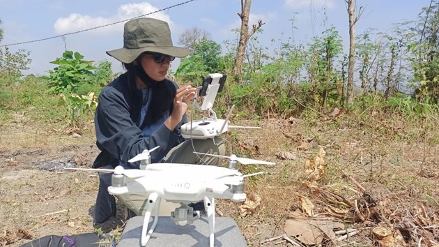
Aerial photo activity of community service in Ngepung Village assisted by ITS students and the local community
ITS Campus, ITS News – As the spearhead of development, a village needs to prepare itself both from data and information that supports sustainable development. Departing from this, three lecturers at the Sepuluh Nopember Institute of Technology (ITS) conducted a community service program by designing maps for underdeveloped villages.
With the title Village Mapping Using Participatory Methods for Village and Area Development (Ngepung Village, Lengkong District, Nganjuk Regency, East Java Province), Dr. Eko Yuli Handoko ST MT, Ir Yuwono MT, and Karina Pradinea Tucunan ST MEng succeeded in creating a map as a basis for development and village development.
Eko Yuli Handoko revealed that since it was determined by the Coordinating Ministry for Human Development as a nationally underdeveloped village, planning and development in Ngepung Village should be a top priority. This is because the village is experiencing a lack of clean water and inadequate road infrastructure. “Besides, there is still a lack of lighting on the main village road,” he added.
For this reason, continued Eko, he and his two colleagues provided output in the form of a village map and a potential map as a solution to these obstacles. Eko said that the map could be used as a village spatial plan, a reference for road infrastructure development and water irrigation canals by utilizing topographical information. “Besides, this map serves as a reference for validating village boundaries,” he said.
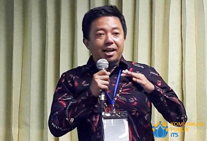
Dr. Eko Yuli Handoko ST MT, Chairman of the ITS Community Service Team in Ngepung Village, Nganjuk Regency
There are six urgencies in making village maps, namely to find out the position of the village against the surrounding area, to see the potential of the village, to resolve disputes over territorial boundaries, to inventory village assets, and to manage Village-Owned Enterprises (BUMDes). Finally, to help plan village infrastructure development, as well as become the basis of information for a spatial integration of regional development, “said the lecturer at the Geomatics Engineering Department.
In making maps, the lecturer is an expert in the field of Marine Satellite Geodesy uses a participatory method. Namely, a method in which the public is involved in the process of data collection and analysis related to issues around them through identification and depiction of geospatial features using mapping tools and technology. “This method can provide a wide space between the government and society to communicate,” he said.
According to this lecturer at the ITS Geodesy and Survey Laboratory, there are two significant elements in this mapping. The first is to provide a village map that does not yet have aerial photographs. This is to make it easier for the village to communicate the potential and existing problems through the village map that has been made by the service team.
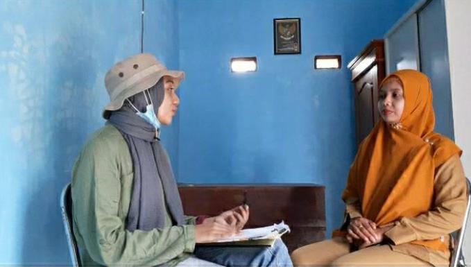
Interview with the Head of Ngepung Village, Dwiyana Bekti (right)
Second, continued Eko, after the map was finished, using the Rapid Rural Appraisal method, he and the team mapped potential problems along with proposed village programs together with the community. “This is intended so that the final map result can be considered in development forums such as musrenbang and so on,” he said.
Even though it was hampered by the Covid-19 pandemic, this service program, which began in early 2020, is running smoothly and will end in December. Previously, Eko and his team had carried out a similar service in Kandangan Village, Gresik. “However, at that time we had not implemented a participatory method so that the community still did not play a role,” he said.
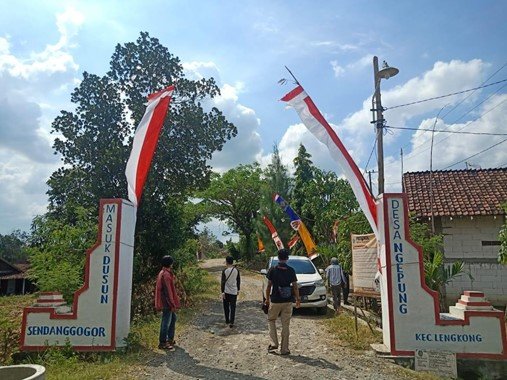
The entrance gate to Ngepung Village, Lengkong District, Nganjuk Regency
At the end of the conversation, Eko hopes that with this program, he and his team can help villages in sustainable village development and development. “Hoped the information on the village map can be used as a reference in the village work program to develop village needs,” he concluded hopefully. (chi/far/ITS Public Relations)
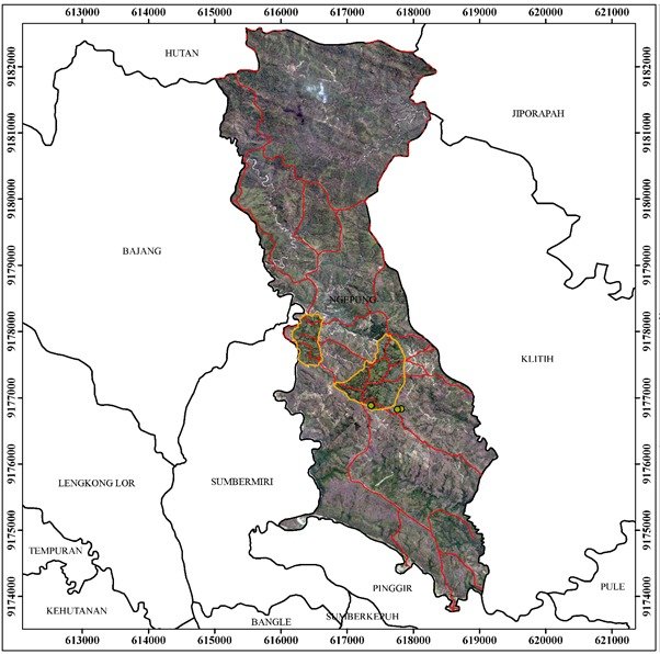
Aerial photo map of Ngepung Village, Lengkong District, Nganjuk Regency made by ITS Abmas Team
Related News
-
Ransomware Attacks PDN, ITS Expert Emphasizes the Importance of Cybersecurity
ITS Campus, ITS News — Challenges arising from technological advancements, ransomware is increasingly evolving and posing significant dangers by
November 12, 2020 19:11 -
ITS Hosts Indoor Handball Event at ASEAN University Games
ITS Rector Ir. Bambang Pramujati, ST, MScEng, PhD delivering the opening remarks for the 21st ASEAN University Games handball
November 12, 2020 19:11 -
ITS and KLHK Invite Young Generation to Anticipate UHI Dangers
ITS Rector Ir Bambang Pramujati ST MSc Eng PhD explaining the Urban Heat Island (UHI) phenomenon currently occurring in
November 12, 2020 19:11 -
Launching worship, ITS team develops MeccaBot application
ITS Campus, ITS News — Ready to help Hajj and Umrah congregations in worship, a team from the Digital
November 12, 2020 19:11