ITS Lecturer Develops A Distribution Map of Covid-19 in East Java

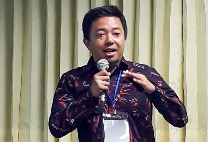
Dr. Eko Yuli Handoko, S.T., M.T., Lecturer of ITS Geomatics Engineering Department
ITS Campus, ITS News – In facing the huge threat of the spread of corona virus or the Corona Virus Disease 2019 (Covid-19) that has become a world pandemic, the Sepuluh Nopember Institute of Technology (ITS) as a technology-based campus has continuously encourage and push efforts in handling the virus with preventive measures. One of these measures being the development of a distribution map of the spread of Covid-19 in East Java.
The map entitled the Covid-19 Guard Map in East Java, is an innovation developed by Dr. Eko Yuli Handoko, S.T., M.T., Lecturer of the ITS Geomatics Engineering Department, in collaboration with the ITS Development Center for Geospatial Information Infrastructure (Pusat Pengembangan Infrastruktur Informasi Geospasial, PPIIG ITS) as well as the ITS Study Center for Mitigation and Climate Change (Pusat Studi Mitigasi Kebencanaan dan Perubahan Iklim ITS). In addition to that, Dr. Eko Yuli Handoko also took a number of students as aids in the creation process, which include Hafezs Satriani Ramadhan, Risa Erfianti, Anisa Nabila Riski Ramadhan, Benedict, and Meilfan Eka Putra.
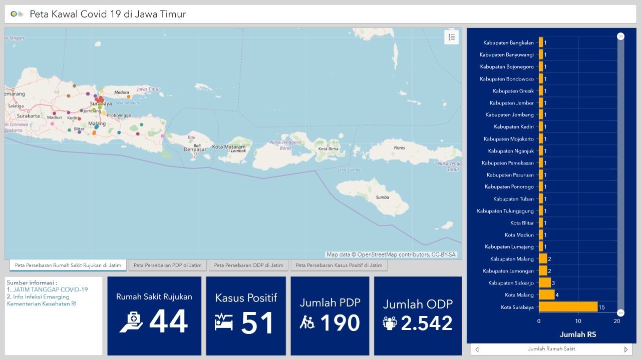
Based on Handoko’s explanation, this Covid-19 Distribution Map is available in four dashboards, which consist of the Distribution Map of Patients Being Observed (Pasien dalam Pengawasan or PDP), Distribution Map of Person Being Monitored (Orang dalam Pemantauan or ODP), Distribution Map of Positive Cases, and Distribution Map of Referral Hospitals in East Java. The term PDP, ODP, and positive, refers to the General Directorate of Disease Prevention and Control, Ministry of Health of the Republic of Indonesia (Kemenkes RI). Distribution Maps of PDP, ODP, as well as positive cases, display the number of people of the three categories in each district or city in East Java. “Based on this number, the distribution map is displayed in different colors,” mentioned by the alumnus of the Bandung Institute of Technology (ITB), Dr. Eko Yuli Handoko.

Distribution Map of the Spread of Covid-19 in East Java, as developed by the ITS Lecturer
Handoko added that the data being displayed is based on the source from the Provincial Government (Pemprov) of East Java. In each dashboard, graphic trends are displayed in the form of line charts that are being updated daily.
The distribution method utilized would be how the spread of the virus is displayed spatially per district or city in the five categories based on statistical analysis. While for the Distribution Map of the Covid-19 Referral Hospitals, the method used is based on the closest proximity (choose the closest location) with a buffer function in the selection of hospitals that are included in the selected area.
The Location-Based Service (LBS) being employed in this analysis can also display the fastest route to arrive at the destination hospital. The hospitals displayed in this map are referral hospitals as recommended by the East Java Provincial Health Office. “The distribution map of referral hospitals is expected to be used by people who need to obtain information fast when they need help with Covid-19,” said the ITS Lector of the Geodesy and Surveying Laboratory.

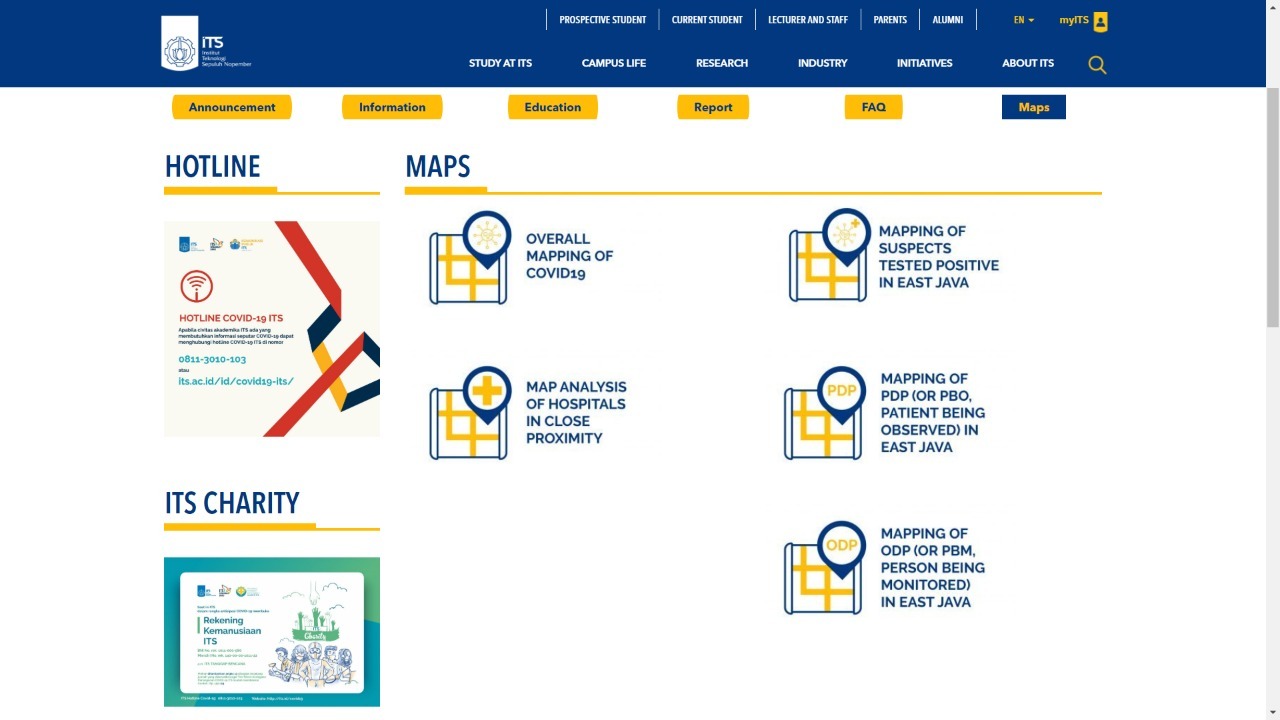
Display of ITS Maps on the official website of ITS
This man who is an expert in the field of Marine Geodesy Satellite, also emphasized that based on the Distribution Map of Patients Being Observed (Pasien dalam Pengawasan or PDP), Persons Being Monitored (Orang dalam Pemantauan or ODP), and Positive Cases, the sharp increase in the number of cases for each category can be identified. Based on the distribution, it can be pointed out that areas of Surabaya and the surroundings of Malang have high numbers, thus special policies are needed to be implemented to prevent further increase. “While regions with relatively small numbers, such as the east and west, can implement policies to prevent an increase,” as said by the graduate of Universidade do Porto, in correlation to the number of suspects.
In response to this, the provincial government and local government can initiate appropriate and effective steps to be applied to the community in order to reduce the number of Patients Being Observed (Pasien dalam Pengawasan or PDP), Persons Being Monitored (Orang dalam Pemantauan or ODP), and Positive Cases. The creation of these maps allows them to serve as ITS’ contribution for the East Java Provincial Government in particular, so that it can be used as additional analysis in any decision-making process related to the world pandemic, Covid-19.

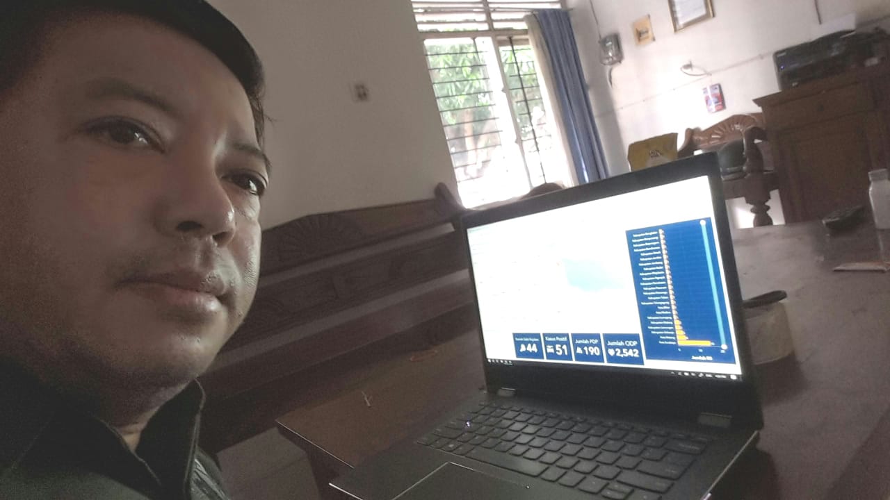
Dr. Eko Yuli Handoko in frame while showing the Distribution Map of Covid-19 in East Java that he developed
The Distribution Map of Covid-19 itself can be accessed on the official website of ITS or via the link https://www.its.ac.id/maps-Covid-19/. Not exclusive to the Distribution Map of Covid-19 in East Java, the team is also reviewing elements related to the demographic and social impacts, that correlates to the spread of Covid-19.
Handoko hopes that in the near future, this study can be added to existing maps. On top of that, an analysis of the prediction of the number of citizens being a case will be displayed, with calculations that are currently being prepared by the ITS Covid-19 Technical Preparedness Team. (Jev/Ory/ITS Public Relations)
Related News
-
ITS Collaboration with BPBD East Java, Launching VR Disaster Simulation
ITS Campus, ITS News — Supporting anticipation of disasters and continuing to educate the public, Institut Teknologi Sepuluh Nopember
March 27, 2020 16:03 -
Supporting the Implementation of Innovative Ideas, ITS and IYSA Hold International Competition
ITS Campus, ITS News — Institut Teknologi Sepuluh Nopember (ITS) has once again proven its commitment to supporting the
March 27, 2020 16:03 -
ITS Maintains Informative Qualification for Five Consecutive Years at KIP Awards
ITS Campus, ITS News — Institut Teknologi Sepuluh Nopember (ITS) has once again successfully maintained its Informative Qualification predicate
March 27, 2020 16:03 -
ITS Strengthens Smart Eco-Campus through UI GreenMetric 2024
ITS Campus, ITS News — Institut Teknologi Sepuluh Nopember (ITS) has once again demonstrated its commitment to environmental concern
March 27, 2020 16:03
