Rain Is Often Scapegoated During Floods

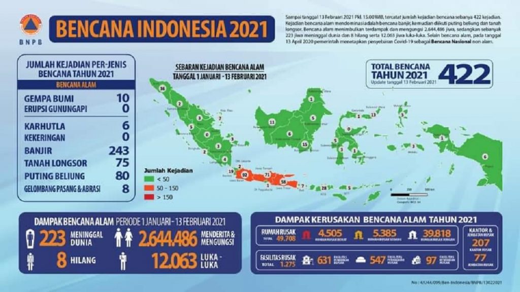
Infographics issued by BNPB related to disasters that occurred in Indonesia in 2021
ITS Campus, ITS News – Since the beginning of 2021, floods have hit various Indonesian regions. Even as of last Saturday (13/2), floods had occurred 243 times, according to the National Disaster Management Agency (BNPB). High rainfall is said to be the leading cause of the floods that hit, but in fact, rain is not the only cause.
Here is Dr. Ir Amien Widodo, M.Si, a disaster researcher from the Sepuluh Nopember Institute of Technology (ITS) on the causes of flooding in Indonesia. Amien explained that a city has generally been designed to withstand the most significant rains ever to avoid flooding.
The capacity of water channels to accommodate rainfall used by a city can reach five to 50 years. It could even use a 100-year plan if there is enough space and money. “Based on the rainfall, rainwater collection channels will be calculated and made with dimensions adjusting the flood discharge that will occur,” said the senior researcher from ITS.
The water catchment channels can be in the form of dams, dozens, or swamps built in various places to accommodate the overflowing rivers. Besides, to accelerate the reduction of floodwater levels, water pumps are installed, and river, wetland, or bottom sediment is usually dredged to prevent sedimentation.
“Planning that the government has carried out can run properly if the community also supports and obeys the regulations made to protect waterways,” said the researcher from the ITS Research Center for Disaster Mitigation and Climate Change (MKPI).
But unfortunately, continued Amien, the waterways that have been constructed are not well maintained in line with the city’s population’s rapid growth rate. According to the Geophysical Engineering lecturer, the land reduction has made people creep and settle on the riverbanks and Bozeman’s edges. They even made the river and bottomed a place for daily garbage disposal.
Unfortunately, garbage disposal in waterways is also often found in ordinary settlements and elite settlements. “This is very worrying because almost all elements of society are still littering. At the end, when the rain pours, many channels start to overflow and flood the entire city,” he said, concerned.
Do not rule out if this continues to be allowed to cause the dam to burst as in the Bandarkandungmulyo Flood, Jombang, which recently occurred. Many villages were submerged in water for days, including the provincial road between Surabaya – Madiun. “The breakdown of the embankment caused the Bandark Bangunanmulyo Flood because it was not strong enough to withstand the overflow of water, which was caused by the discharge of the Konto Jombang River, which was held back by the accumulation of wood, trees, and garbage at the Gudo sluice,” explained Amien.
Amien also revealed that the Gudo sluice’s trash had been known to the public a few days before. However, because no action was taken immediately, the dam broke. “Through this incident, we learned that there is a need to build a special communication line between the community around the river and the river manager,” he explained.

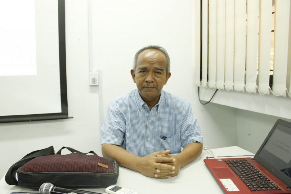
Senior Researcher from the ITS Center for Mitigation, Disaster and Climate Change Research (MKPI), Dr. Ir. Amien Widodo, M.Si
He added that various parties’ cooperation is needed to participate in monitoring rivers and river dams, especially in the peak position of the rainy season as it is today. Not only that, but Amien also explained the typical signs of a collapsed dam, which are usually shown several days before the rainy season.
These include, among others, the presence of cracks either parallel to or cutting the embankment. “If the crack reaches the bottom of the embankment, it can be followed by water seepage on the body, base, or foundation under the embankment, then this seepage can enlarge followed by an erosion process that erodes the embankment soil in the direction of the embankment crack,” he explained.
Furthermore, Amien explained that the erosion that has occurred could widen and deepen when the rain pours. Cracks parallel to the dam can be followed by landslides on the inside, outside, and at the dam’s base. “Therefore, do not let the river water level rise parallel to the embankment or overtopping or the water overflows above the embankment, it indicates that the situation is serious and must be reported immediately,” he said.
To avoid a recurrence of the flood disaster, Amien said that the government must provide socialization in a structured, systemic and massive manner. Structured means that all parties, especially those who live around the river, are understanding the importance of keeping the dimensions of the river as planned. To be systemic, means to maintain all parties’ togetherness in one unit to protect the river.
“It is highly recommended that the authorities such as Public Works and Housing (PUPR) create an early warning system for various problems in the river so that people can immediately report any problems and can be immediately responded to and followed up,” suggested Amien. Meanwhile, massively, all policies are known to all parties, both the authorized leadership and the public.
At the end of the interview, Amien asked the public to be more aware of how to protect and restore rivers and mountains’ main function as flood prevention. “It is the time for the government and the community to increase capacity in disaster management. I hope that when a disaster occurs, we can be resilient in facing it, and everyone will be safe and can save each other,” he concluded. (ris/ITS Public Relations)
Reporter : Megivareza Putri Hanansyah
Related News
-
ITS Collaboration with BPBD East Java, Launching VR Disaster Simulation
ITS Campus, ITS News — Supporting anticipation of disasters and continuing to educate the public, Institut Teknologi Sepuluh Nopember
February 15, 2021 16:02 -
Supporting the Implementation of Innovative Ideas, ITS and IYSA Hold International Competition
ITS Campus, ITS News — Institut Teknologi Sepuluh Nopember (ITS) has once again proven its commitment to supporting the
February 15, 2021 16:02 -
ITS Maintains Informative Qualification for Five Consecutive Years at KIP Awards
ITS Campus, ITS News — Institut Teknologi Sepuluh Nopember (ITS) has once again successfully maintained its Informative Qualification predicate
February 15, 2021 16:02 -
ITS Strengthens Smart Eco-Campus through UI GreenMetric 2024
ITS Campus, ITS News — Institut Teknologi Sepuluh Nopember (ITS) has once again demonstrated its commitment to environmental concern
February 15, 2021 16:02
