The ITS Team Takes a Role in Handling the Eruption of Mount Semeru

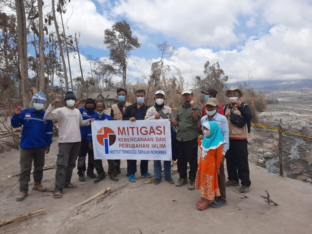
Field visit of the ITS MKPI team and IKA ITS to Umbulan Hamlet, Supiturang Village, Lumajang
ITS Campus, ITS News – Institut Teknologi Sepuluh Nopember (ITS) showed its concern for the Mount Semeru eruption disaster that occurred on December 4th through a visit to Umbulan Hamlet, Supiturang Village, Pronojiwo District, Lumajang for three days since last Monday (13/12). . The visit was carried out by a team from the ITS Mitigation, Disaster, and Climate Change Research Center (Puslit MKPI) in collaboration with a team from the ITS Alumni Association (IKA).
A senior researcher from the ITS MKPI Research Center, Dr. Ir Amien Widodo MSi, said that Mount Semeru released two things, namely hot clouds and lava floods. Hot clouds have a speed of up to 200 kilometers per hour and can reach temperatures exceeding 100 degrees Celsius, impacting burning trees in watersheds.

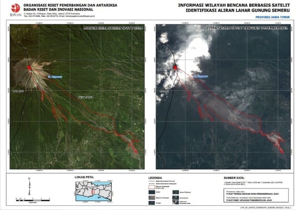
Map affected by the eruption of Mount Semeru
From this, according to Amien, there needs to be a high level of vigilance for residents, especially those on the banks of the river. “We hope that there will be communication between the residents of the upstream and downstream areas when an eruption occurs, such as a disaster hazard button,” he reminded.
Amien explained that the MKPI Research Center team and IKA ITS visited the area affected by Mount Semeru to conduct a disaster study. The results could be used as recommendations for disaster management in the future. This survey visit includes geological surveys, volcanology, hydrology, mapping of affected areas, and drone surveys. “The survey data is processed into a map of the affected area which will be analyzed with a pre-existing map,” said the ITS Geophysical Engineering lecturer.
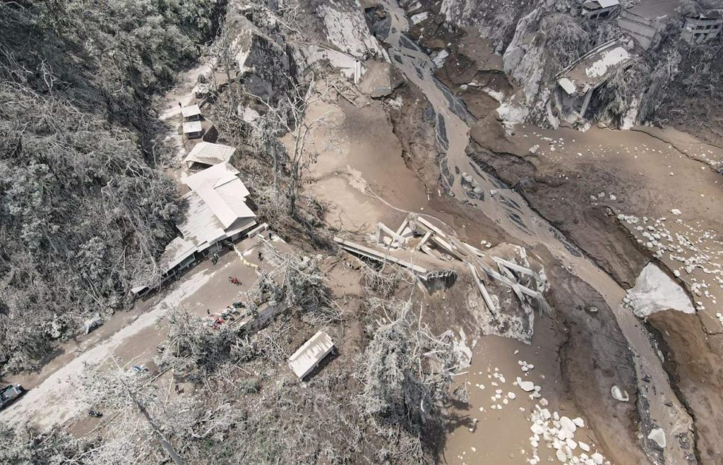
 The Gladak Perak Bridge that connects Lumajang-Malang is broken due to hot clouds and lava floods from Mount Semeru.
Amien further explained that another threat from this eruption is landslides and rain, and hot clouds. However, the volcano monitoring post does not yet have this observation system. It can be used as further research so that other impacts from this volcanic eruption do not occur. “In the future, a sensor warning system tool related to landslides can be made and put into a monitoring post to increase awareness of mountain activities,” he said.
Meanwhile, MKPI Research Center team member Dr. Techn Umboro Lasminto ST MSc said that there was a potential for aftershocks to be feared due to the widespread lava accumulation area. This causes changes in the direction of river water flow so that the flow of water is not controlled and is exacerbated by rainy conditions that occur until April.

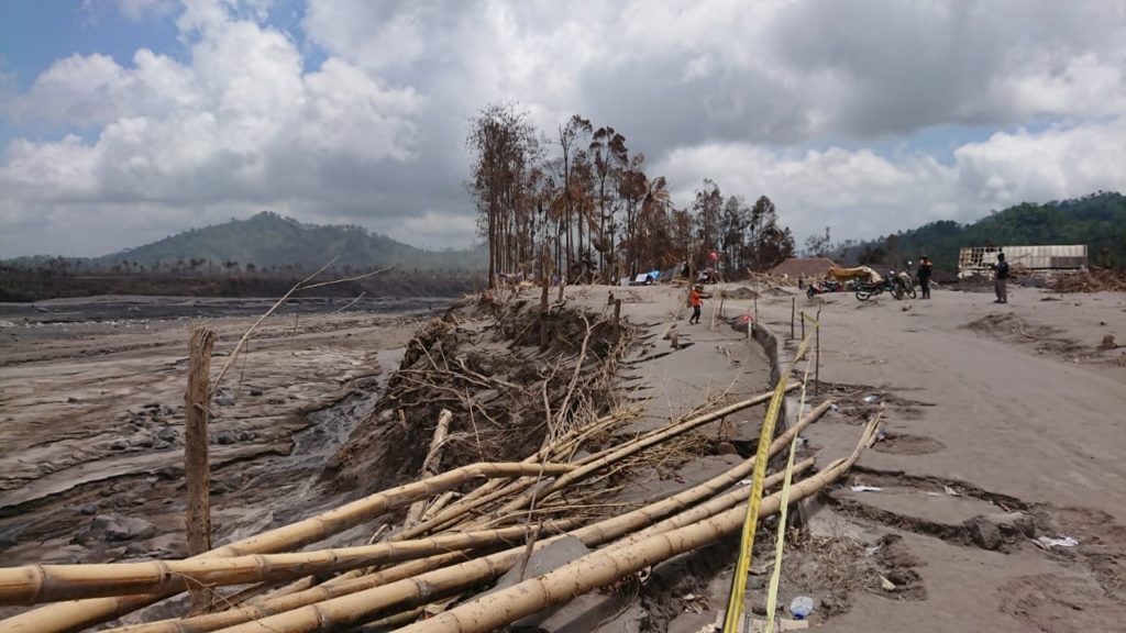
Trees burned and fell due to hot clouds in Umbulan Hamlet, Supiturang Village, Lumajang.
He revealed that the formation of a new direction of river flow could lead to residential areas, which could cause flooding. “The thing that must be done is to find a solution so that the direction of the water flow returns to the original river flow,” explained the ITS Civil Engineering lecturer.
Another team member, M Haris Miftakhul Fajar M Eng, reminded us that with the eruption of Mount Semeru, this is not the time to blame each other. Still, it is time to maximize the role of each existing stakeholder. “In addition, we also have to evaluate related to the early warning system, the disaster mitigation process, and socialization to the population,” he said.
For an early warning system, according to this ITS Geophysical Engineering lecturer, it is necessary to complete visual observations with a thermal camera that can capture hot clouds at large volumes. “As academics, we also need to conduct research related to this type of eruption of Mount Semeru,” concluded the ITS geologist. (ITS Public Relation/far)
Reporter: Rayinda Santriana Umi Sholihah
Related News
-
ITS Collaboration with BPBD East Java, Launching VR Disaster Simulation
ITS Campus, ITS News — Supporting anticipation of disasters and continuing to educate the public, Institut Teknologi Sepuluh Nopember
December 17, 2021 17:12 -
Supporting the Implementation of Innovative Ideas, ITS and IYSA Hold International Competition
ITS Campus, ITS News — Institut Teknologi Sepuluh Nopember (ITS) has once again proven its commitment to supporting the
December 17, 2021 17:12 -
ITS Maintains Informative Qualification for Five Consecutive Years at KIP Awards
ITS Campus, ITS News — Institut Teknologi Sepuluh Nopember (ITS) has once again successfully maintained its Informative Qualification predicate
December 17, 2021 17:12 -
ITS Strengthens Smart Eco-Campus through UI GreenMetric 2024
ITS Campus, ITS News — Institut Teknologi Sepuluh Nopember (ITS) has once again demonstrated its commitment to environmental concern
December 17, 2021 17:12
