Dasina, ITS Solution to Support North Natuna Sea Defense

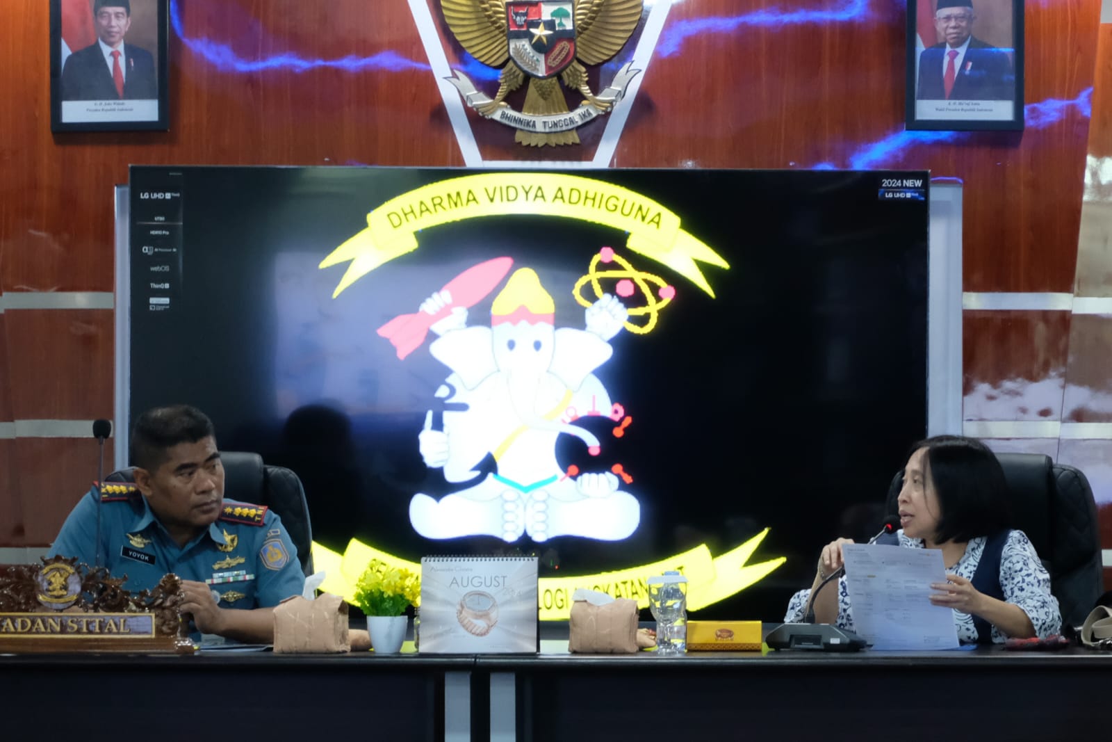
Head of the ITS Abmas KKN Team Prof. Erma Suryani ST MT PhD (right) during a discussion with STTAL Deputy Commander Colonel Laut (P) Yoyok Nurkarya Santoso ST MT.
Kampus ITS, ITS News — Institut Teknologi Sepuluh Nopember (ITS) continues to spread benefits in various fields, including in the field of defense. This was realized through the development of the Indonesian Defense Geotechnology Strength Simulation Dashboard in the North Natuna Sea (Dasina) by the ITS Community Service Real Work Lecture (KKN Abmas) team.
The head of the ITS Abmas KKN team Prof. Erma Suryani ST MT PhD said that the North Natuna Sea is a very strategic area of Indonesia. This region also has enormous natural resource potential. “However, this region is faced with various challenges, both in terms of security and the environment,” explained Erma during the Dasina demonstration, last Tuesday (20/8).
These challenges prompted the team from the ITS Department of Information Systems; ITS Center for Public Policy, Business and Industry Studies (PKKPBI); and Telkom University to collaborate with the Naval Technology College (STTAL) to develop Dasina. The interactive dashboard, which was demonstrated at STTAL’s Soewarso Building, is capable of presenting data and information related to Indonesia’s strength in the North Natuna Sea region. “Dasina will be useful for decision-making in operational, tactical and strategic fields,” he said.
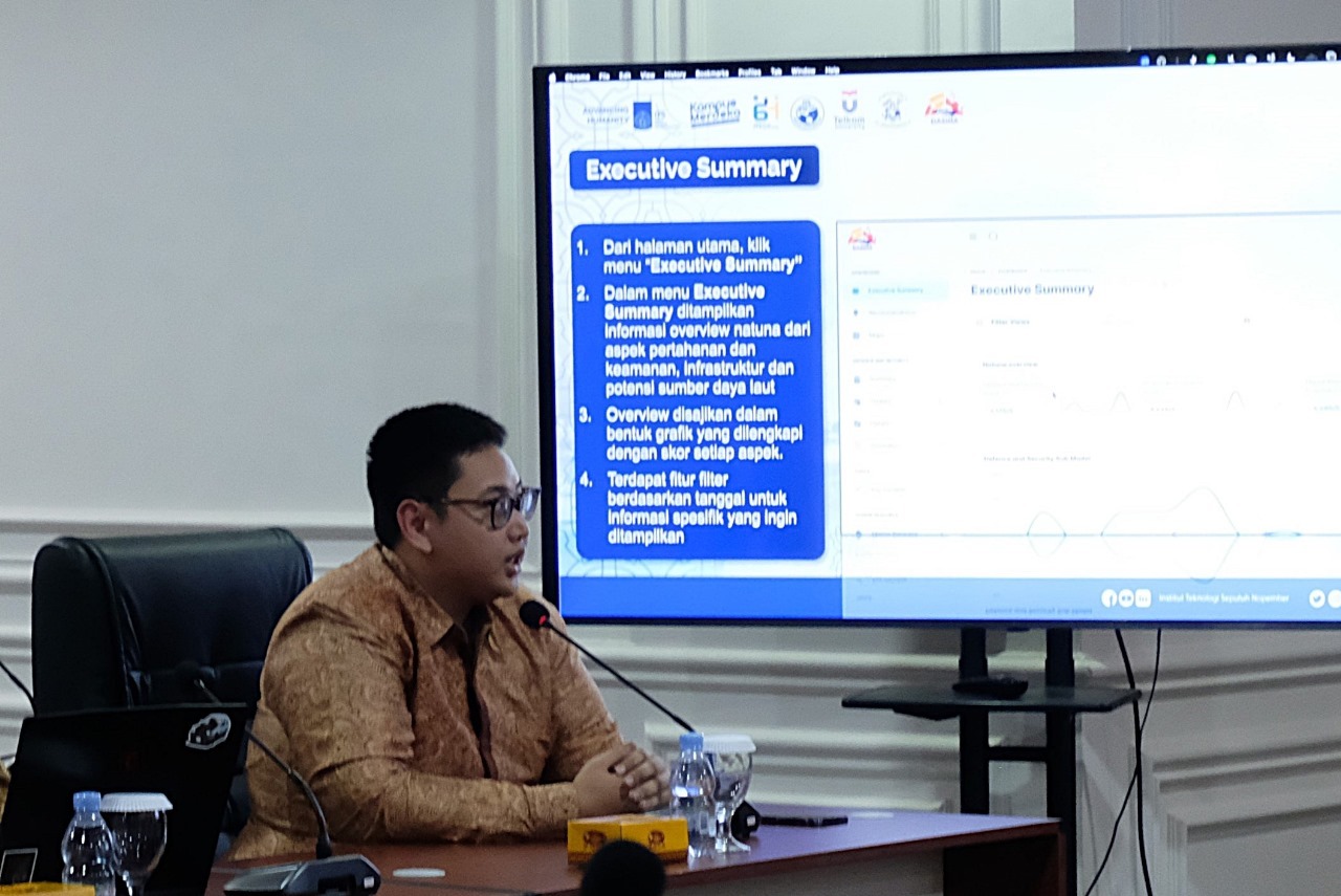
To maximize its potential, there are several features integrated in this dashboard. Broadly speaking, these features are divided into two parts. The first section consists of an executive summary, recommendations, policy briefs, and maps. The executive summary shows a summary of the current conditions in the North Natuna Sea based on three perspectives, namely defense and security (hankam), hankam infrastructure, and marine resources.

Moch Farrel Arrizal Kusuma, one of the KKN Abmas ITS team members, explains the features of Dasina.
Furthermore, the recommendations feature provides some policy suggestions that can be taken to overcome the challenges faced by the North Natuna Sea. The recommendations come from the policy brief feature which provides some of the problems that are plaguing the southern tip of the South China Sea. Then, the Abmas ITS team also provides a map feature that shows the boundaries of the region as well as monitoring of ships passing through the region.
The second part of the dashboard contains a model that can analyze conditions in the North Natuna Sea. In this section, the team led by a professor from the ITS SI Department integrated the Vensim application with Dasina. The Vensim application itself is used to develop and package dynamic feedback models. Through this integration, Erma and her team created a model capable of calculating and projecting various variables that are significant in the defense and security of the North Natuna Sea in Dasina.
The developed model was then integrated with the Dasina platform and translated into three features. The first feature is threats, which contains various challenges faced by the North Natuna Sea, ranging from military, non-military and mixed challenges. The second feature is a simulation consisting of a base model, scenario model, and outcome model. The third feature is a summary that displays a summary of the results of the analysis that has been carried out.
Deputy Commander of STTAL Colonel Laut (P) Yoyok Nurkarya Santoso ST MT said he was happy to see the results of the Dasina demonstration conducted by the Abmas ITS KKN team. According to him, the various features contained in the dashboard can help the Navy’s force planning in the North Natuna Sea. “Hopefully, some input from the discussions held today can be applied so that this dashboard becomes more perfect,” he said hopefully. (ITS Public Relations )
Reporter: Muhammad Fadhil Alfaruqi
Related News
-
Promoting Inclusive Education Access, ITS Signs MoU with CT Arsa Excellence High School
ITS Campus, ITS News – In an effort to break the chain of poverty through the education sector, Institut
August 24, 2024 03:08 -
Economic Limitations Are Not a Barrier, ITS Meets the Dreams of New KIP-K Students
Tulungagung, ITS News – Demonstrating its commitment to supporting equal access to education, Institut Teknologi Sepuluh Nopember (ITS) directly picked up prospective
August 24, 2024 03:08 -
ITS Opens Opportunity to Enter Mining Engineering Study Program via Independent Path
ITS Campus, ITS News — After being officially opened, Institut Teknologi Sepuluh Nopember (ITS) socialized its new study program (Prodi), namely Mining
August 24, 2024 03:08 -
Innovating AI-Based Stock Analysis, ITS Team Wins International Award
ITS Campus, ITS News — The rapidly moving investment world demands technological solutions to make it easier for investors to
August 24, 2024 03:08
