ITS Introduces Autonomous Bathymetric Survey Vehicle for Water Mapping
News PIU HETI


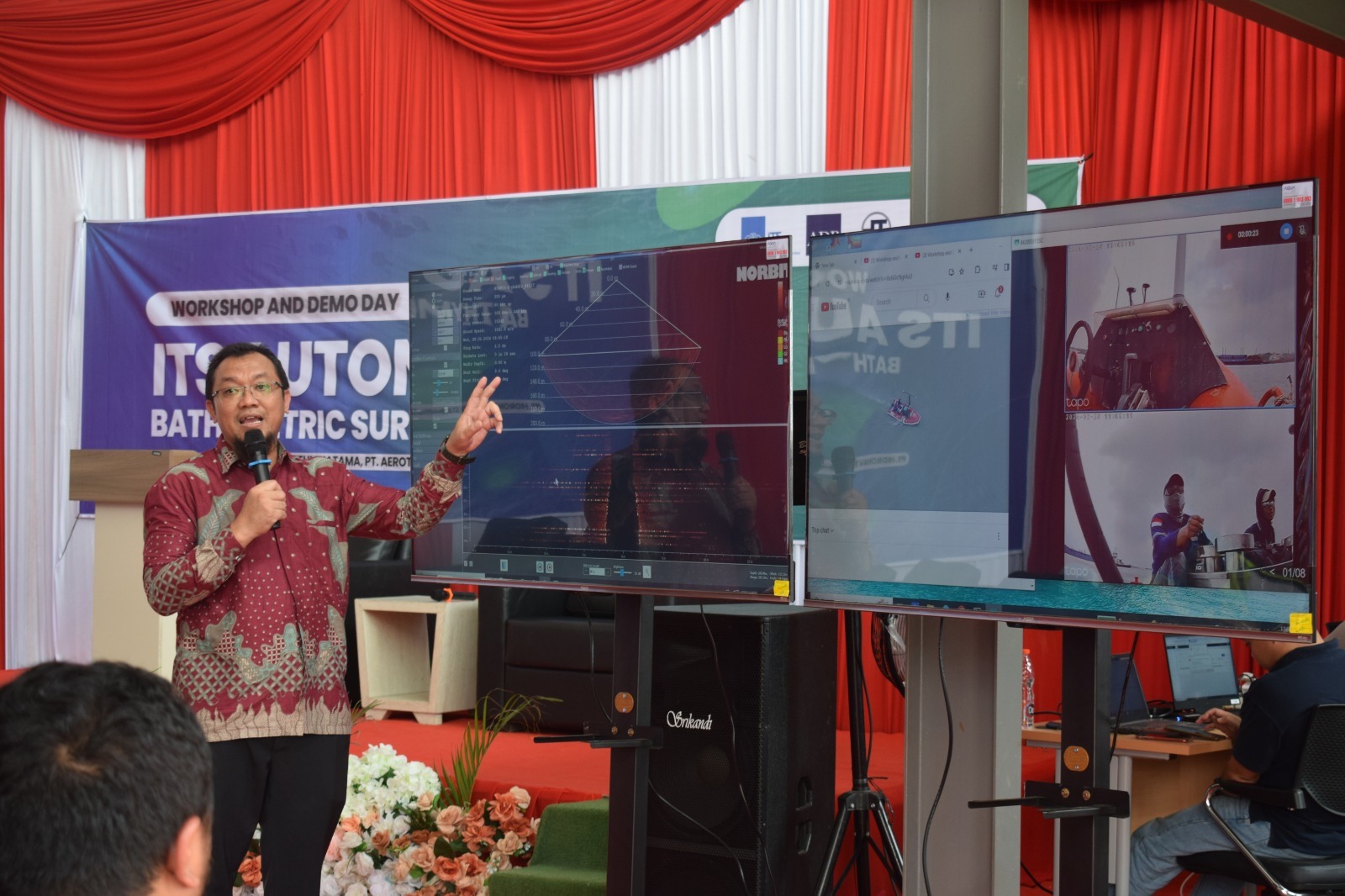
Head researcher Danar Guruh Pratomo ST MT PhD, when explaining the innovation of the Autonomous Bathymetric Survey Vehicle at the ITS Demoday
ITS Campus, ITS News – Institut Teknologi Sepuluh Nopember (ITS) showed its excellence again in the maritime world by innovating the intelligence boat (i-Boat) for hydrographic survey operations. This innovation, the Autonomous Bathymetric Survey Vehicle, was officially introduced at Demoday on Wednesday (28/2).
The Head Researcher, Danar Guruh Pratomo ST MT PhD, explained that the Autonomous Bathymetric Survey Vehicle is an autonomously operated boat integrated with bathymetric survey measurement instruments. “With the help of this system, surveyors will be able to conduct measurements without having to be physically present in the field,” Danar explained.
Furthermore, Danar said that the boat can be used for various needs, including depth mapping in the port area to determine shallowing locations. With precise and accurate bathymetric data results, the Autonomous Bathymetric Survey Vehicle can reach almost all depths of seas, lakes, rivers, and port areas.
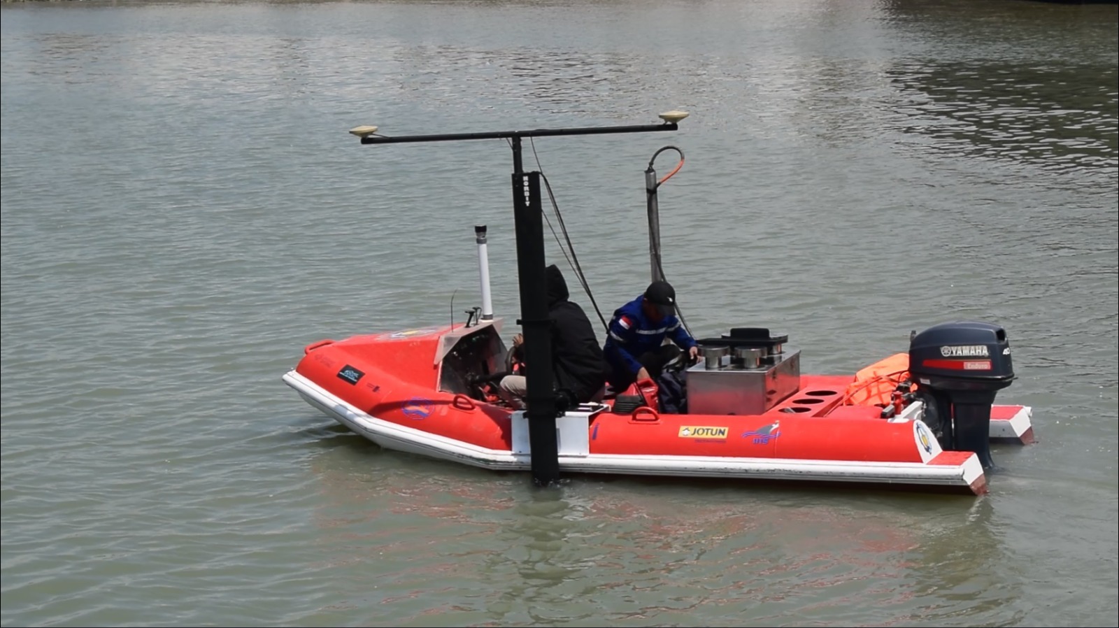
Demonstration of ITS Autonomous Bathymetric Survey Vehicle innovation in Kamal Harbor Pier Area, Bangkalan Regency, Madura
The instruments installed on the i-Boat are the Multibeam Echosounder (MBES) to determine the topography at the water bottom and the Sub-Bottom Profiler (SBP) to image the sediment layers at the water bottom. Besides, Light Distance and Ranging (Lidar) sensors and Telemetry Sensors are also installed to detect distance and objects in the survey area. “To determine the position coordinates, we use a satellite system,” he explained.
The Head of ITS Geomatics Engineering Department said that these instruments can enhance survey efficiency, especially in shallow waters. The reduction in field surveyors can offer a cheaper economic value. “The main benefit is minimizing the risk of work accidents for the surveyors themselves,” Danar said.
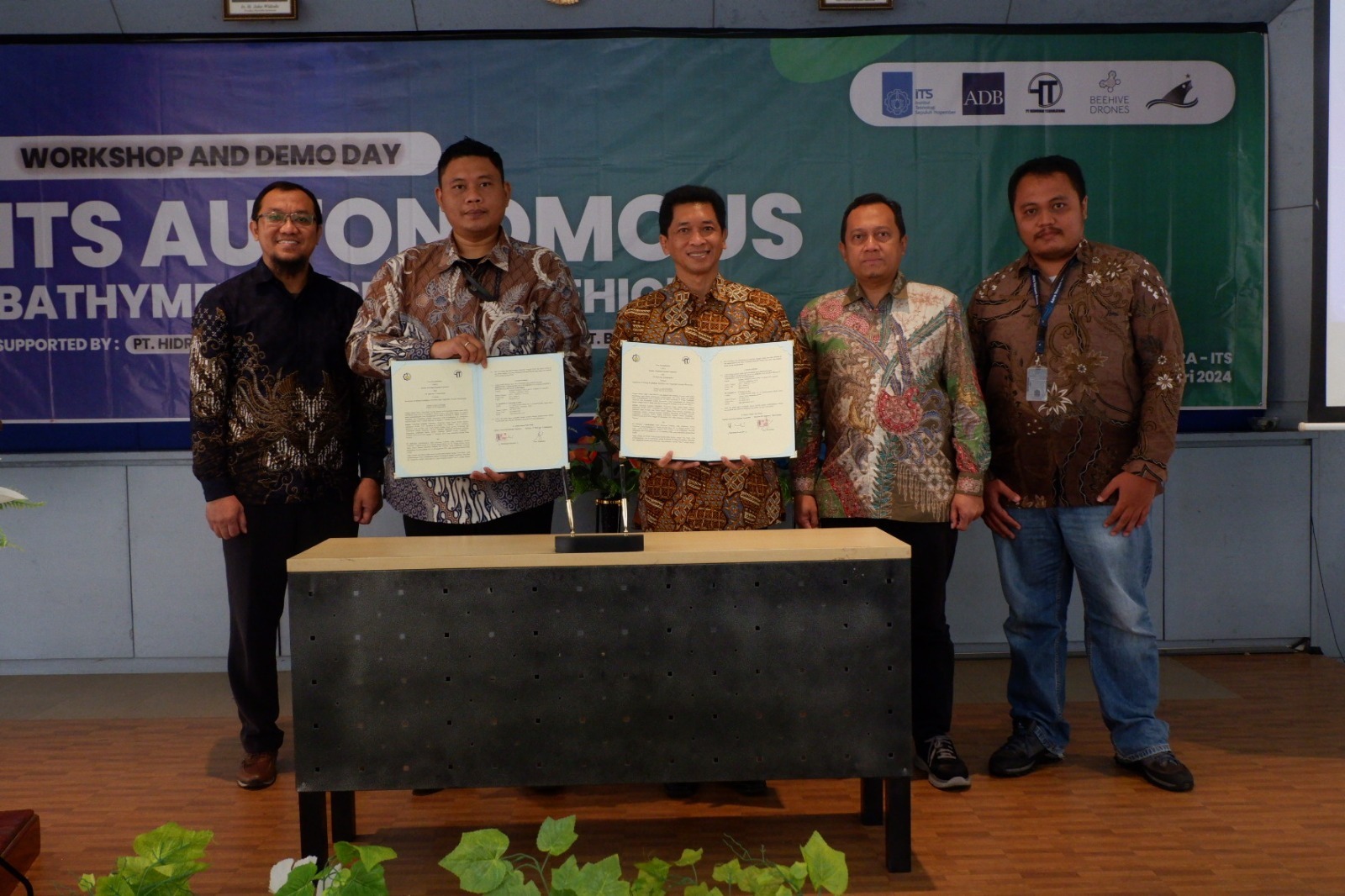
The moment after signing the collaboration agreement between ITS, PT Hidronav Tehnikatama, and PT Aerotek Global Innovasi at Demoday ITS event in Bangkalan, Madura
The activity held at the Science Techno Park (STP) ITS – Gapura Maritime Innovation Center & Teaching Factory in Bangkalan, Madura, was also collaborated with industry parties in the maritime technology field such as PT Hidronav Tehnikatama, PT Aerotek Global Inovasi, and PT Bintang Timur Samudera. This research is also part of the Higher Education for Technology and Innovation (HETI) program, supported by the Asian Development Bank (ADB).
On the same occasion, The Vice Rector IV of ITS, Ir Bambang Pramujati ST MSc Eng PhD, stated that this innovative product demonstrates the improvement of the ITS maritime field. He hopes that ITS could become a leading institution in the maritime field. “Hopefully, this Autonomous Bathymetric Survey Vehicle can be used by related partners for surveys in water areas,” Bambang expected. (ITS Public Relations)
Reporter: Rayinda Santriana US
Translator: Alya Farah Nabila
Latest News
-
Improve Spatial Data Accuracy, ITS Launches Low-Cost GNSS Receiver
ITS Campus, ITS News –In an effort to support the efficiency of spatial data management, Institut Teknologi Sepuluh Nopember
-
Go-to-Market Business Pitching Workshop to Enhance the Presentation Skill of ITS’ Innovative Product Team
Kampus ITS, ITS News – Institut Teknologi Sepuluh Nopember (ITS) The HETI project demonstrates a commitment for capacity development
-
Enhancing Project Management: HETI ITS Visit to LPIT ITB
As part of its project management strategy, the HETI Project Implementation Unit (PIU) ITS paid a visit to the