Coal Shipping Channel Diversion Saves Karimunjawa
News-EN
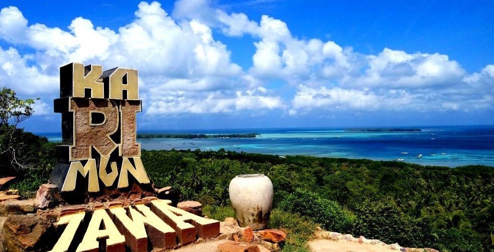
Karimunjawa Islands, Jepara Regency, Central Java (source : karimunjawa.jepara.go.id)
Karimunjawa is an archipelago located in jepara regency, Central Java, which has a marine park tourism that becomes the prima donna of local and foreign tourists. Karimunjawa is also a national park area whose environmental sustainability is protected, but karimunjawa’s underwater ecosystem is now threatened by the number of coal barges that carry out anchoring in the Karimunjawa National Park Area. Therefore, through an article written for Integrated Coastal Zone Management, Sepuluh Nopember Institute of Technology (ITS) the author wants to present the problems faced in Karimunjawa National Park and solutions that can be applied based on existing research.
As an archipelago located in the northern part of Java Island, Karimunjawa has a cluster of islands consisting of 22 islands with a total area of 111,625 ha consisting of the island’s land and surrounding waters. Karimunjawa National Park is designated as a Marine Reserve through the Decree of the Minister of Forestry No.123/. Kpts-II/1986, which was converted into Karimunjawa National Park in 2011. And designated as a Marine Nature Conservation Area through the Decree of the Ministry of Forestry No. 74/Kpts-II/2001.
Biodiversity diversity is a major factor in the development of tourism areas. Biodiversity of various types of coral reefs, seagrasses, and mangroves in karimunjawa islands indicates that karimunjawa islands are able to give a new nuance in traveling on small islands. The development of ecotourism activities in karimunjawa islands is carried out through the utilization of coastal natural resources that are increasingly high so that it is needed limits on the utilization of resources so as not to damage the environment. The development of various tourist attractions in karimunjawa Islands must also pay attention to various physical parameters to match the ability of the land and not exceed the carrying capacity of its environment.
Karimunjawa National Park is managed by Karimunjawa National Park Hall which has the main task to manage environmental ecosystems to be protected from problems that can disrupt the sustainability of Karimunjawa marine ecosystems such as overfishing and anchoring coal barges in the Karimunjawa National Park Area.
To support its tourism potential, Karimunjawa also has shark breeding, Anora Beach, Cemara Besar Island, Joko Tuwo Hill, Geleang Island, Central Island, Sintok Island, Sunan Nyamplungan Cemetery Religious Tourism, Maer Nyamplungan Spot, Batu Putih Beach, Alun-alun, Barakuda Beach, Nirwana Beach, Bakololo, Karimunjawa Butterfly Park, Gosong Island, Bugis Karimunjawa Village, Ujung Batu Lawang Beach, Mrican Pier, Mangrove Tracking along two kilometers, Small Fir Island , Cilik Island, Gelang Island, Menjangan Kecil Island, Legon Lele Beach, Ujung Gelam Beach, Menjangan Besar Island, Bobi Beach, Pancoran Beach, Love Hill, and Batu Topeng Beach as the main charm of this archipelago tourism that can be accessed from Jepara.
Karimunjawa Islands is also a national park rich in coral reefs, seaweed, mangroves, coastal forests and lowland tropical rainforests. The area is home to three species of turtles and nearly 400 species of marine fauna, including hundreds of ornamental fish. Karimunjawa has long been one of the most popular tourist destinations in Indonesia.
The development of coastal areas itself can be done through various sectors, both industrial sectors, inter-community relations in coastal areas, improving the quality of life and education as well as protection of coastal environment consisting of coastal land areas and marine areas that include life and underwater ecosystems, one of which can support the creation of natural tourism potential.
Protection of ecosystems and coastal areas is one of the crucial things considering the high environmental damage that occurs in Indonesia today. The development of coastal areas in the future must also pay attention to environmental sustainability, the presence of factories and industrial activities in coastal areas themselves contribute a little damage to the environment. The resulting waste and other environmental destruction can kill the coastal ecosystem.
In this case, Former Vice President of the Republic of Indonesia, Jusuf Kalla once said, “We need to maintain marine capacity and increase coastal natural resources. So far, fishermen have problems, because they do not have a source of funds, then coastal human resources must be able to maintain and take care of their environment,” in the Sustainable Development Goals (SDGs) Annual Conference with the theme “Sustainable Life for Our Ocean” in Jakarta 2019. The participation of coastal communities is also very necessary to maintain the sustainability of coastal areas so that the ecosystems contained in them can be continuously protected.
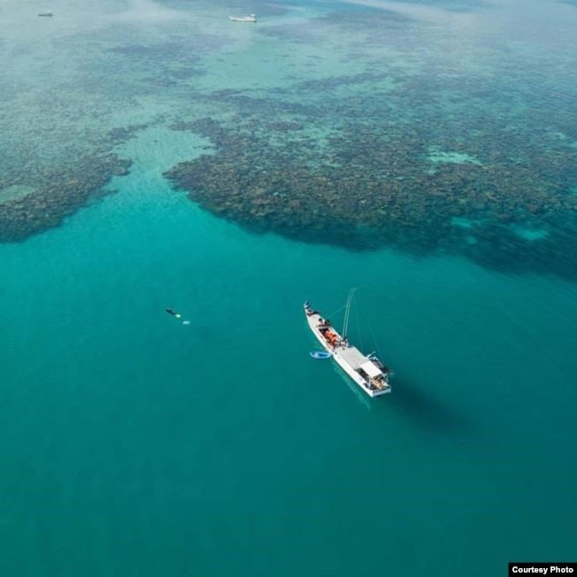
Panoramic View of Coral Reefs in Karimunjawa Waters (source : greenpeace.org)
Karimunjawa Islands are also famous for their beautiful coral reefs. Beautiful marine life with a very good level of coral density, even better than the coral reefs in Raja Ampat.
The development of tourism in karimunjawa national park area becomes a fresh wind for the life of karimunjawa coastal communities. With the large number of tourists coming both from national and foreign tourists who come to enjoy the beauty of Karimunjawa National Park brings new opportunities and livelihoods for the surrounding community. Environmental sustainability in Karimunjawa National Park is certainly the main focus for people in the coastal area, considering that tourists come to visit to enjoy the natural beauty in Karimunjawa.
Unfortunately, that beauty is now being continued by the activities of tugboats and barges transporting coal. These ships often do anchoring in karimunjawa area. Along the way, many problems encountered by the coal carriers, damaged engines, depleted fuel, and weather constraints are often the reasons that make these ships need calm waters to stop and lower anchors, The relatively calm waters of the Karimunjawa Area is the place where the ships choose to lower anchors. Not only one, even seventy barges were once ‘parked’ in karimunjawa National Park Area.
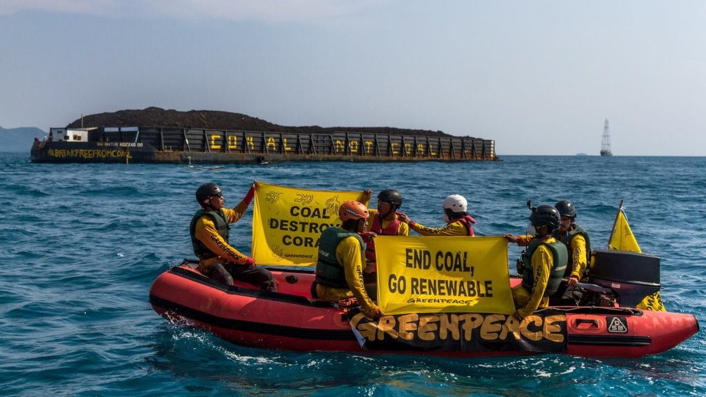
Protest Against Coal Barges by Greenpeace (source : greenpeace.org)
The presence of coal-hauling barges threatens the sustainability of the coral reefs of Karimunjawa National Park. The damage to coral reefs that occur is certainly a detriment to karimunjawa marine ecosystems due to the loss of the function of coral reefs as marine biota habitats. Thus, the damage to the coral reefs will certainly interfere with the survival of marine biota and reduce the diversity of karimunjawa sea.
With the level of coral reef damage in Karimunjawa due to environmental destruction by both rogue fishermen and coal barges that carry out anchoring in Karimunjawa National Park has even reached 26 percent, so to recover up to 100 percent on each square meter of damage takes about 65 years. Presented by Munasik, a Coral Reef Ecologist, the value of coral reef ecosystem losses in Karimunjawa National Park is Rp12,245,419 per square meter. national GDP in 2012. The amount of losses caused by damage to coral ecosystems, it advises the government to make the value / price of the national ecosystem as one of the variables of calculating environmental damage losses.
On the other hand, the existence of coal barges themselves is inevitable, given the very high public need for electricity. The abundance of coal in Indonesia makes the use of coal as a prime source of energy for power plants because of its cheaper price so as to reduce production costs. Coal mines are also scattered in Kalimantan, Sumatra and Papua. Coal from these mines is then sent to the pltu (Steam Power Plant) which is also widely found in Java Island.
In order for the coal supply for the PLTU to continue to run while protecting the coral reefs in Karimunjawa National Park, efforts are needed to divert the shipping flow from the coal barges.
Algorithm A* (A star) is one of the route determination models that studies have been done to determine the diversion of coal barge routes in karimunjawa. A Star algorithm that belongs to the informed search algorithm which is the shortest route search algorithm by combining the distance function and heuristic function of a search.
The algortima, discovered by Nils Nilsson, Peter Hart, and Bertram Raphael of the Stanford Research Institute, was first published in 1968. The A* algorithm can also be applied to weighted graphs because A* requires distance functions and heuristic functions derived from side weights. The A* algorithm formulated over the distance function is added with the heuristic function to get the optimum cost from the starting point to the destination. This heuristic function itself is the approximate value for a node reaching the destination node, the better or worse. With the formulation:
F(x) = g (x) + h(x)
Where g(x) is distance or cost, and h(x) is a heuristic function that is the approximate for a node to its tendency to approach the point of destination. It appears that the value of the A* algorithm formula is the sum of its cost and heuristic functions. The value of this formula will be used to determine the node of the route problem.
The shortest route search with the A* algorithm is designed to be able to point to the destination point, as in the following figure;
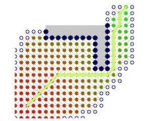
Algoritma A*
A* algorithms are more effective and efficient at determining the shortest route of a node. This happens because of the influence of heuristic functions that make the A* algorithm do not have to trace relative nodes away from the destination. The application of Algorithm A* to determine the shipping lanes of coal barges so as not to damage coral reefs and environmental ecosystems in karimunjawa National Park Area is carried out in several stages, namely the preparation of barge routes by modeling routes in the form of graphs showing the port points where the coal barges set out to deliver their cargo to the pltu in Java Island, and the distribution of pltu that will receive the coal barges in the areas around Karimunjawa National Park.
Algorithm A* diverts the route of coal barges into circling karimunjawa National Park Area to go to Batang Power Plant, Taking the direct route to Tanjung Jati Power Plant and Rembang Power Plant through Rembang waters.
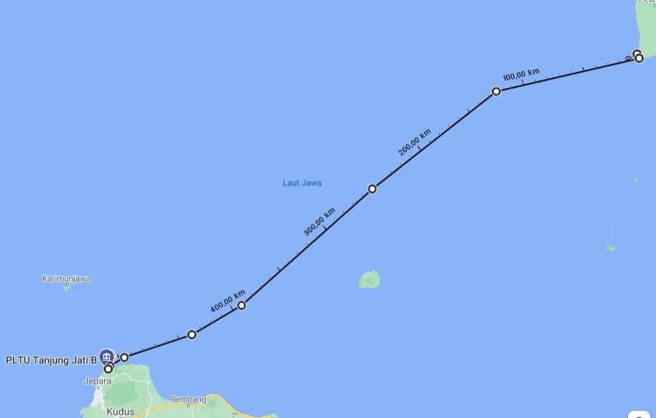
New Coal Cruise Route uses Barges to avoid Karimunjawa National Park area
The application of this diversion of shipping lanes is very necessary to be able to solve the problem of coral reef damage in karimunjawa National Park Area. In the future, regulations are also needed that prohibit coal barges from anchoring and passing through karimunjawa waters, to protect the environmental and coastal ecosystems of Karimunjawa National Park.
Reference:
Syaiful Anwar. 2019. Penerapan Algoritma A Star dalam Menetukan Jalur Tongkang Batu Bara untuk Mencegah Kerusakan Terumbu Karang di Karimunjawa. Makalah IF2211 STrategi Algoritma, Semester II Tahun 2018/2019. Sekolah Teknik Elektro dan Informatika, Institut Teknologi Bandung (ITB).
Written By :
Refiantika Rachma Utami
Students Department of Marine Transportation Engineering
Class of 2017
Latest News
-
Department of Marine Transportation Engineering ITS Prioritizes Students from the Indonesian Island Regions in the SNBT and 2023 Achievement Selection
Marine Transportation Engineering Main Building, Institut Teknologi Sepuluh Nopember ITS Campus, Seatrans News – Department of Marine Transportation Engineering,
-
Seatrans Industrial Visit Again!
ITS Campus, SEATRANS News – In supporting learning activities at the Department of Marine Transportation Engineering, field trips are
-
SEATRANS SUPER SAILING REBORN 2022 GOES TO LABUAN BAJO
Titled Seatrans Super Sailing (Triple S) Reborn, this annual activity of the Department of Marine Transportation Engineering is back


