Rainfall Used to be Blamed as The Factor to Cause The Flood, An Explanation by Dr. Amien Widodo
Information
Dr. Ir Amien Widodo, M.Si, a Disaster Researcher from the Institut Teknologi Sepuluh Nopember (ITS) gave an explanation of the causes of flooding in Indonesia, which a city is generally designed to be able to face the biggest rain ever to avoid flooding.

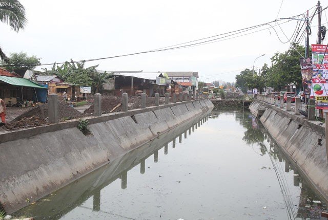
One of river channels in Surabaya, precisely on Jalan Babatan (source: Radar Surabaya)
The capacity of river channels to accommodate rainfall used by a city can reach five to 50 years. It could even use a 100 year plan if there is enough space and fund. “Based on the rainfall, river channels can be calculated and made with dimensions adjusting the flood solution”, said the senior researcher from ITS.
The river channels can be in the form of embankments, bozems, or swamps that are built in various places to accommodate the overflowing rivers. In addition, to accelerate the reduction of flood water levels, water pumps are installed and river, swamp, or bozem sediment is usually dredged to prevent sedimentation.
“Planning that has been carried out by the government can run properly if the community also supports and obeys the regulations made to protect river channel,” said the researcher from the ITS Research Center for Disaster Mitigation and Climate Change (MKPI).

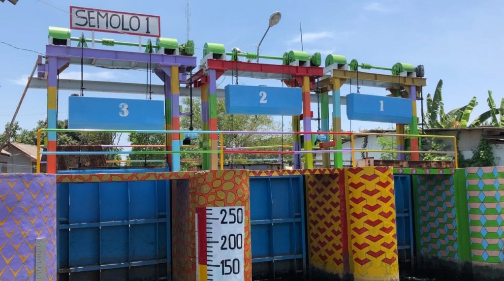
One of flood gate in Surabaya, precisely in Semolowaru area (source: Jatimnow.com)
Unfortunately, continued Amien, the river channels that have been constructed are not in line with the rapid growth rate of the city’s population. According to this Geophysical Engineering lecturer, the land reduction has made people start to encroach and settle on the riverbanks and the edges around bozem. They even made the river and bozem a place for daily garbage disposal.
Unfortunately, garbage disposal in river channel is also often found in ordinary settlements and in elite settlements. “This is very worrying because almost all elements of society are still littering. In the end, when the rain pours, many channels start to overflow and flood the entire city,” he said concerned.
If this continues, it is not impossible that it will cause the embankment to burst, as in the case of the Bandarkandungmulyo Flood, Jombang which recently occurred. Many villages had flood in days including the provincial road between Surabaya – Madiun. “The Bandarkedungmulyo flood was caused by the breakdown of the embankment because it was not strong enough to withstand the overflow of river, which was caused by the discharge of the Konto Jombang River which was held back by the accumulation of wood, trees and garbage at the Gudo flood gate,” explained Amien.

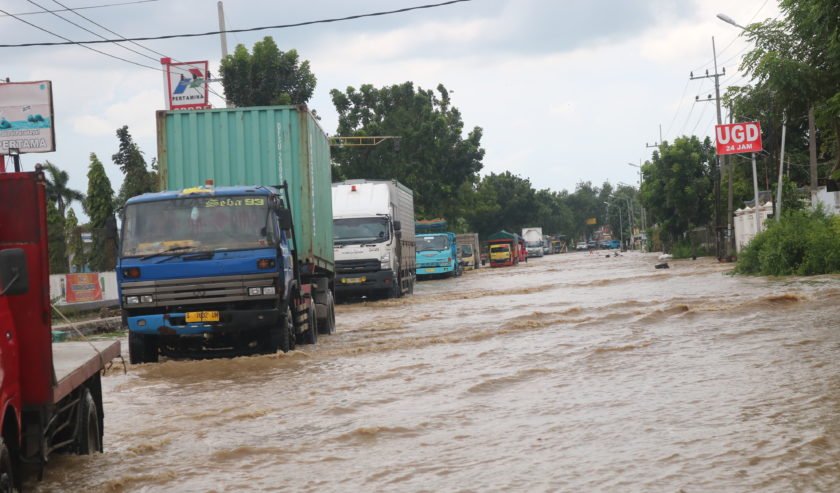
The flood occured in Kecamatan Bandarkedungmulyo, Jombang, Friday 5 February 2021 (source: SuaraSurabaya)
Amien also revealed that the pile of trash at the Gudo flood gate had actually been known by public a few days before. However, because no action was taken immediately, the embankment broke. “Through this incident, we learned that there is a need to build a special communication forum between the community who lives around the river and the city government,” he explained.
He added that the cooperation of various parties is needed in monitoring rivers and river embankments, especially in the peak position of the rainy season as nowaadays. Not only that, Amien also explained the typical signs of a collapsed embankment, usually shown several days before the rainy season.
Another typical sign is the presence of cracks either parallel or cutting the embankment. “If the crack reaches the bottom of the embankment it can be followed by water seepage on the body, base, or foundation under the embankment, then this seepage can enlarge followed by an erosion process that erodes the embankment soil in the direction of the embankment crack,” he explained.
Furthermore, Amien explained that the erosion that has occurred can widen and deepen when the rain pours. Cracks parallel to the embankment can be followed by landslides on the inside, outside, and also at the base of the embankment. “Therefore, do not let the river water level rise parallel to the embankment or over topping or the water overflows above the embankment, this indicates that the situation is serious and must be reported immediately,” he said.
To avoid a recurrence of the flood disaster, Amien said that the government must provide socialization in structured, systemic and massive way. Structured means that all parties, especially those who live around the river, are given an understanding of the importance of keeping the dimensions of the river as planned. To be systemic, it means to maintain the togetherness of all parties in one unit to protect the river.

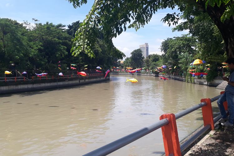
The view of Kalimas river, Surabaya (source: Kompas.com)
“It is highly recommended that the authorities such as Public Works and Housing (PUPR) establish an early warning system for various problems in the river, so that people can immediately report any problems and can be immediately responded to and followed up,” suggested Amien. Meanwhile, massively it means that all policies are known to all parties, both the authorized leadership and the public.
At the end of the interview, Amien asked the public to be more aware of how to protect and restore the main function of rivers and mountains as flood prevention. “It is time for the government and the community to increase capacity in managing disasters. I hope that when a disaster occurs we can be resilient in facing it, and everyone is safe and can save each other,” he concluded. (HUMAS ITS)
Latest News
-
Pertajam Keilmuan Petrofisikamu dengan Studi Kasus Di Dunia Oil and Gas, dalam PETROPHYSICS TRAINING 2025!
Teknik Geofisika ITS mengajak anda untuk mendalami pengetahuan dan masalah-masalah yang terjadi seputar Petrofisika dalam acara PETROPHYSICS TRAINING 2025.
-
Kuliah Tamu “Bahaya Geologi Penurunan Tanah Daerah Pesisir Pantai Utara Jawa”
Teknik Geofisika ITS menyelenggarakan Kuliah Tamu “Bahaya Geologi Penurunan Tanah Daerah Pesisir Pantai Utara Jawa” dengan mengundang narasumber dari
-
WEBINAR “CERITA SUKSES UGG KEBUMEN & UGG MERATUS”
Teknik Geofisika ITS dan Ikatan Ahli Geologi Indonesia (IAGI) menyelenggarakan webinar “Cerita Sukses UGG Kebumen dan UGG Meratus”, mengundang


