The Investigation of The Maritime Civilization Trail on Brantas Delta River
Information
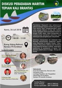
This research has investigated the geography conditions of Majapahit kingdom when it was still existing, and aimed to examine the history of the sedimentation process and looked for the trace of the port/ dock. Then this study reconstructed the building of castile and its conditions around digitally and there are real model of the condition of Majapahit era.
As known, the lost of Majapahit left too few hint and left too much question. What caused the collapse of the Majapahit, was it because of the war or because of a disaster? Or both of them. Historically, it was mentioned that its collapse due to attacks by other kingdoms towards its kingdom centers.
In fact, many buildings, structures and artifacts collapsed and down buried in the ground about 1-3 meters. This shows there are other incidents happened at the same time, before or after the war. Volcanic data around Majapahit shows that it was active, such as Arjuno Welirang and Kelud mountain. It means that volcanic eruptions and lava floods could sink Majapahit civilization. Data on seismic studies in East Java have found many active faults or the faults that can cause earthquakes. It seems clearly contributed to the destruction of Majapahit
The discovery of some building structures in Kedungbocok Village, Terung Village, Watesari Village prove that many buildings are actually hidden in the Sidoarjo Regency. About how is the overall shape of the hidden building, requires help of an underground scanner. That is why the head of the Kedungbocok Village sent a letter to ITS to help scanning the building structure.
The Geotechnical and Environmental Laboratory of the Geophysical Engineering Department ITS Surabaya planned to measure various geophysical methods including geoelectric, georadar, soil sampling with drill etc. At this initial stage we conducted geoelectric method.
Resistivity geoelectric is one of various geoelectric methods that is often used in geophysical surveys for relatively shallow exploration, including being used in investigating springs, the condition of subsurface structures and can also be used as supporting investigation of mining materials. Exploration in its applications mostly use the resistivity geoelectric method which can provide information that other methods cant do.
The principle of conducting resistivity surveys is to flow electric current down to earth through two current electrodes which are plugged into two ground points and then measure the potential difference response that occurs between two other points on the surface where two potential electrodes are placed in a certain arrangement.
From the measurement data obtained, namely the potential difference and current strength, which can be processed to get the apparent resistivity values for each electrode spacing. These points are pictured on log-log graph paper to get a field curve. This field curve is then interpreted to get the thickness and resistivity values of the subsurface layer of the earth.
In the geoelectric method survey, the value of potential difference, current value and resistance value of the rock type could be obtained. Rock resistance that is obtained directly is a pseudo-type resistance that requires further data processing to get the actual type of resistance for each layer. The actual type of resistance is described as a 1D cross section at each station. Then from the 1D display, it can be developed into a 2D cross section with a mapping method by correlating each station.

Latest News
-
Beradaptasi dengan Sesar Aktif Penyebab Gempa Darat, Belajar dari Gempa Myanmar
1. Belajar dari Gempa Myanmar Jumat, 28 Maret 2025, pukul 13:20:56 WIB wilayah Mandalay, Myanmar, diguncang gempabumi tektonik. Gempa
-
Kembangkan Deep Nueral Network dan IOT Dalam Carbon Capture Storage, Mahasiswa Teknik Geofisika ITS Sabet Juara 2
Dua Mahasiswa Teknik Geofisika ITS berhasil menjuarai kompetisi nasional INCEPTION 2025. Dimas Xavier Saivascello (5017241010) dan Luvin Diart Lazertino
-
Mahasiswa Teknik Geofisika ITS Sabet Juara 1 Petrowell Study Case Competition
Tiga Mahasiswa Teknik Geofisika ITS berhasil menjuarai kompetisi nasional di bidang Oil & Gas. Tim mahasiswa yang terdiri E.T.A.


